Uludağ National Park Orienteering Experience
About the experience
Uludağ National Park: Spruce Forest and Glacial Traces at High Altitude
Uludağ National Park, rising above Bursa, offers one of the most unique terrains in Turkey for orienteering. The plateaus that rise to over two thousand meters have an air that is much cooler than the city below; even in the middle of summer, you can enjoy a comfortable walking temperature in the afternoons. The area is largely covered by tall-trunked spruce forests. The trees are mostly spaced out and covered with needle leaves, making it easier to walk and providing the necessary visibility to compare the terrain with the map.
What makes Uludağ special is the presence of glacial traces from the ice age. The small lakes, rock blocks, depressions, and moraine ridges in the high sections create dozens of distinct features that can be distinguished from one another. These features are represented on the map by contour lines and rock symbols; as the participant learns to find the shape they see on the map, their confidence in navigation increases rapidly. The open plateau above the forest boundary is a unique area for practicing reading the map at a wide angle.
The Flow of the Guided Experience
We start the day at the gathering area on the edge of the plateau. The guide first explains the scale of the map, the north lines, and the color codes; then you try to hold the compass in your hand, orient the map to the north, and take a walking direction to a target. Distances can be deceptive at high altitude, so we also work on a practical method of estimating distances by counting steps.
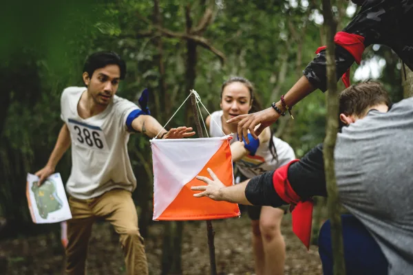
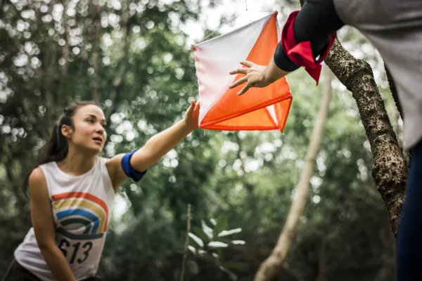
After the warm-up, we move on to the control points. Each circle on the map corresponds to an orange-white control flag hanging in the terrain; the description next to it tells you which rock, pit, or stream feature the flag is standing on. You record your passage by reading your electronic SI card at the unit at the point. At the end of the course, all leg times appear on the screen, and you evaluate where you hesitated with the guide. The guide advances with the group at the first points, then leaves the decisions to you.
Levels, Duration, and Preparation
The program is suitable for adults and families; you may have never held a compass before. For beginners, there is a short course following trails and distinct ridges around the plateau, and for the more experienced, there is a longer option that requires choices within the spruce forest. The half-day program is three to four hours, and the full-day program is six hours, including a lunch break and a second course. Children can share the same course with their parents.
The weather in Uludağ can change quickly: be sure to bring long pants, a thin polar fleece, and a windproof outer layer. Sturdy hiking boots, sunglasses, at least one and a half liters of water, and a small snack will be sufficient. The guide has a whistle, a first aid kit, and a map showing the area boundaries; the group does not go outside the defined area, and if fog sets in, the course is shortened. This is a national park: we do not collect plants, do not light fires, carry our trash with us, and behave respectfully towards wildlife. Create your registration now for limited capacity.
📷 Fotoğraf Galerisi
3 Fotoğraf


What's included & not included
Included
- Expert guide
- Orienteering map
- Compass & control card
- Starting briefing
- Safety supervision
Not included
- Transport
- Food and drinks
- Personal equipment (proper shoes, water)
- National park entrance fee (if any)
Activity location
Just arrive 20 min before your booking.
Cancellation and Refund Terms
Under Article 15(g) of Law No. 6502 on Consumer Protection and the Distance Contracts Regulation, there is no statutory right of withdrawal or cancellation for sports, entertainment, leisure and activity services that must be provided on a specific date or period.
Reviews
No reviews yet for this listing. Be the first to leave one!